

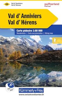
Val Kümmer Hiking maps of Switzerland- Val d'Anniviers / Val d'Hérens
We konden geen prijzen vinden voor dit productGelukkig hebben we een paar sterke alternatieven voor je gevonden, deze vind je verder op de pagina.
Vergelijkbare of betere producten

Black Diamond Distance Carbon Z Poles Trailrunning Poles Desert Sky 105 cm
Bekijk productBekijk productNee|Geen sluitsysteem|386 g|16 cm
v.a. € 127,96
-7%
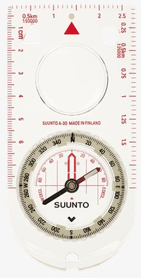
Suunto A-30 CM/L/NH Kompas - Transparant
Bekijk productBekijk productMagnetisch kompas voor navigatiedoeleinden|1 cm|11,4 cm|5,7 cm
v.a. € 33,32
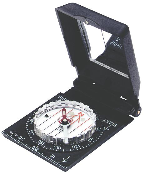
Silva Schneider Silva Ranger SL Kompas - Zwart - Spiegelkompas
Bekijk productBekijk productMagnetisch kompas voor navigatiedoeleinden|Transparant|Zwart|Nee
v.a. € 40,00
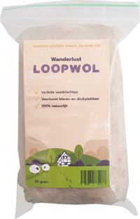
Wanderlust Loopwol Crème 10 g
Bekijk productBekijk productNee|Naproz Bv|Niet medisch middel|Ja
v.a. € 11,50
- Verstelbaar
- Sluitsysteem
- Verpakkingsgewicht
- Verpakking breedte
- Vanaf prijs
- Nee
- Geen sluitsysteem
- 386 g
- 16 cm
- v.a. € 127,96Bekijk product-7%
- -
- -
- -
- 5,7 cm
- v.a. € 33,32Bekijk product
- -
- -
- -
- -
- v.a. € 11,50Bekijk product
Overige kenmerken
- Verpakkingsgewicht
- 88 g
- Verpakking breedte
- 13 cm
- Verpakking lengte
- 20 cm
- Verpakking hoogte
- 1,5 cm
- EAN
- 9783259022238
Opties en functies
- Verstelbare flappen
- Nee
Productinformatie
- Geschikt voor wasdroger
- Nee
Productomschrijving
Val d'Anniviers / Val d'Hérens 23 k&f 1:60 000
Kümmerly+Frey has created this series of hiking maps covering the whole of Switzerland in co-operation with cantonal and local walking path organizations. 32 sheets, guide you through Switzerland's most beautiful hiking and touring areas. Suggested walks are divided into the categories "walking path", "mountain path" and "alpine route". All maps feature useful additional information: accommodation, eating and drinking, bus-routes with stops, sports, leisure...etc
Maps with index and regional approach map, water- and rip-proof.
On each paper map you will find a unique access-code to download the digital map for free on your smartphone.
Kümmerly+Frey has created this series of hiking maps covering the whole of Switzerland in co-operation with cantonal and local walking path organizations. 32 sheets, guide you through Switzerland's most beautiful hiking and touring areas. Suggested walks are divided into the categories "walking path", "mountain path" and "alpine route". All maps feature useful additional information: accommodation, eating and drinking, bus-routes with stops, sports, leisure...etc
Maps with index and regional approach map, water- and rip-proof.
On each paper map you will find a unique access-code to download the digital map for free on your smartphone.
Reviews
Er zijn nog geen reviews geschreven
Heb jij dit product in bezit en wil je graag je mening geven? Start dan hieronder met het schrijven van je review. Afhankelijk van de details duurt het schrijven van een review gemiddeld tussen de 3 en 10 minuten. Met jouw mening help je andere bezoekers een betere keuze te maken én maak je iedere maand kans op €250,-! Klik hier voor de actievoorwaarden.