

Tanzania, National Geographic Tanzania, Rwanda, Burundi

We konden geen prijzen vinden voor dit productGelukkig hebben we een paar sterke alternatieven voor je gevonden, deze vind je verder op de pagina.
Vergelijkbare of betere producten
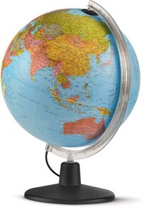
Atmosphere Globe - Dag & Nacht - 30 cm - Met Verlichting
Bekijk productBekijk productNR-0331H2ND-NL|Atmosphere|Kunststof|8007239983205
v.a. € 42,59
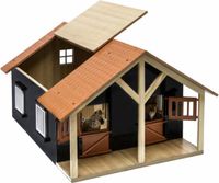
Kids Globe Paardenstal met 2 Boxen en Berging - 1:24 - Bruin - Hout
Bekijk productBekijk product8713219332788|Van Manen Veenendaal BV|0|Kinderen
v.a. € 49,99
Kids Globe Speelkleed Verkeer met Led verkeerslichten - 72x120 cm
Bekijk productBekijk productAuto|22 cm|Technology|Universeel
v.a. € 25,90

Minecraft 3D Toppeez Collectible Mystery Blindbox Figure Toy Assorted
Bekijk productBekijk productNee|Nee|8721246991908
v.a. € 12,94
- MPN (Manufacturer Part Number)
- Merk
- Materiaal
- EAN
- Vanaf prijs
- NR-0331H2ND-NL
- Atmosphere
- Kunststof
- 8007239983205
- v.a. € 42,59Bekijk product
- -
- -
- -
- 8713219332788
- v.a. € 49,99Bekijk product
- -
- -
- -
- 8721246991908
- v.a. € 12,94Bekijk product
Overige kenmerken
- Verpakking lengte
- 23,5 cm
- Verpakkingsgewicht
- 90 g
- Verpakking breedte
- 11,3 cm
- Verpakking hoogte
- 1,2 cm
- EAN
- 9781566956192
Opties en functies
- Verstelbare flappen
- Nee
Productinformatie
- Geschikt voor wasdroger
- Nee
Productomschrijving
&; Waterproof &; Tear-Resistant &; Travel Map
Home to Mount Kilimanjaro and some of Africa's most popular safaris, Tanzania has bountiful opportunities for adventure travelers. Covering the region with unparalleled detail is National Geographic's Tanzania, Rwanda and Burundi Adventure Map. This expertly researched map combines topographical information, points of interest and a road network, making it the most comprehensive map available and the perfect compliment to any guidebook. The map's front side covers the western half of Tanzania and the entirety of Rwanda and Burundi, along with Lakes Victoria and Tanganyika, and Serengeti and Ruaha National Parks. While the reverse side covers the country's eastern half to its Indian Ocean shoreline as well as the islands of Mafia, Zanzibar and Pemba, the cities of Dar es Salaam and Dodoma, Selous Game Reserve, Ngorongoro Conservation Area and Kilimanjaro National Park.
Find cities, towns and protected areas quickly with a user-friendly index. A mapped transportation network of major and secondary roads, tracks, border crossings, harbors, railway lines and ferry routes will help you get to your destination. Pinpointed on the map are national parks and reserves, kopjes, swamps, mangroves, areas of forest cover, scenic viewpoints, archeological sites, caves, churches, mosques, rock engravings, museums, hotels, lodges, campsites, beaches, diving areas, coral reefs and shipwrecks along with many other cultural, historical, ecological and adventure points of interest, including many hidden gems.
Every Adventure Map is printed on durable synthetic paper, making them waterproof, tear-resistant and tough &; capable of withstanding the rigors of international travel.
- Map Scale = 1:1,315,000
- Sheet Size = 25.5'' x 37.75''
- Folded Size = 4.25'' x 9.25''
Reviews
Er zijn nog geen reviews geschreven
Heb jij dit product in bezit en wil je graag je mening geven? Start dan hieronder met het schrijven van je review. Afhankelijk van de details duurt het schrijven van een review gemiddeld tussen de 3 en 10 minuten. Met jouw mening help je andere bezoekers een betere keuze te maken én maak je iedere maand kans op €250,-! Klik hier voor de actievoorwaarden.