
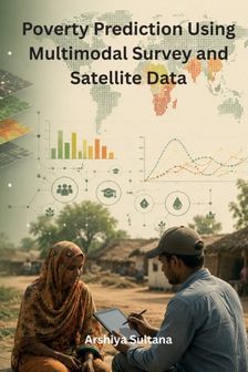
Poverty Pippet Sky Poverty Prediction Using Multimodal Survey and Satellite Data

Poverty Pippet Sky Poverty Prediction Using Multimodal Survey and Satellite Data

Alle 2 prijzen en aanbieders

Meest populaire keuze – Scherpste prijs!
Amazon· Bekende aanbieder
€ 49,02
-31% prijsdaling
3 tot 4 dagenVerz. € 9,99
Check de website voor de levertijd | Gratis bezorgd > €20,-
Bekijk product
Bekijk product
Amazon Marketplace· Marketplace
€ 49,02
3 tot 4 dagenVerz. € 9,99
Check de website voor de levertijd | Gratis bezorgd > €20,-
Bekijk product
Bekijk product

Specificaties

Overige kenmerken
Taal handleiding
en
Verpakking breedte
15,2 cm
Verpakking hoogte
0,8 cm
Verpakking lengte
22,9 cm
EAN
9798868955938

Productomschrijving

The analysis of poverty and socioeconomic conditions increasingly benefits from combining traditional survey information with remotely sensed and geospatial data. Poverty Prediction Using Multimodal Survey and Satellite Data provides a focused technical examination of poverty prediction, multimodal data integration, machine learning, socioeconomic analysis, satellite imagery, and geospatial data processing. The book connects data science, remote sensing, geographic information systems, machine learning, and development-oriented analytics within an interdisciplinary framework.The book introduces the foundations of poverty measurement and computational approaches to socioeconomic prediction. Household and community surveys can provide detailed information about income, assets, employment, education, housing conditions, access to services, and other socioeconomic characteristics. While survey data can offer rich contextual information, collecting such information across large geographic areas can be resource-intensive. Satellite and remotely sensed data provide a complementary source of spatial information that can be analyzed alongside survey observations.A central focus is placed on multimodal data integration. Combining information from different sources requires methods for aligning, preprocessing, representing, and analyzing heterogeneous datasets. Survey variables may be structured as tabular observations, while satellite information can contain spatial and image-based features. The book examines general approaches for bringing these different data modalities into a common analytical framework for poverty prediction.Satellite data and remote sensing are considered as sources of geographically distributed information relevant to socioeconomic analysis. Remotely sensed observations can contain information about settlement patterns, land characteristics, infrastructure, vegetation, built environments, and other spatial features. The book discusses how such information can be processed into computational features that complement socioeconomic variables obtained through surveys.

Er zijn nog geen reviews geschreven

Vraag 1 van 4

Heb jij dit product in bezit en wil je graag je mening geven? Start dan hieronder met het schrijven van je review. Afhankelijk van de details duurt het schrijven van een review gemiddeld tussen de 3 en 10 minuten. Met jouw mening help je andere bezoekers een betere keuze te maken én maak je iedere maand kans op €250,-! Klik hier voor de actievoorwaarden.

Welk cijfer geef jij dit product?